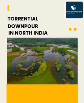
In the early weeks of July , northern states like Himachal Pradesh, Uttarakhand, Punjab & Haryana, received torrential downpours , causing landslides, flash floods, widespread damage to highways and other infrastructure.
According to the India Meteorological Department, from a 10% deficiency in rainfall till end of June, the monsoon’s surge over the west coast & parts of northern India in the past week has led to a 2% excess rainfall over the country.
According to IMD, there is 59% excess rainfall over northwest India; 4% excess over central India; 23% deficiency over peninsular India and 17% deficiency over east and northeast India.
There was record rainfall over Chandigarh at 32 cm; Ambala 22 cm; Delhi 15 cm; Nangal 28 cm; and Ropar 27 cm, among several other places in Haryana & Punjab till second week of July, leading to severe flooding. Bhuntar in Himachal Pradesh recorded 10 cm & Mandi recorded 8 cm rain .
Himachal Pradesh as a whole recorded 103.8 mm rainfall against a normal of 8 mm, which makes it 1,193% excess rainfall. Similarly, Punjab recorded 57.5 mm against the normal of 4.6 mm rainfall, making it 1,151% excess for the day. Shimla recorded 5.5 cm of rainfall; Kangra 5.9 cm; Chamba 5.6 cm; Chandigarh 6.3 cm; Patiala 6.1 cm; and Ambala 4.1 cm.
According to, Director general of the weather bureau, M. Mohapatra, the heavy rainfall is due to an interaction between a western disturbance & the monsoon. “The interaction is causing heavy to very heavy rainfall over Jammu and Kashmir, Himachal Pradesh, north Punjab and Haryana, Uttarakhand.
According to, M Rajeevan, former secretary, ministry of earth sciences, recent Himachal Pradesh floods remind us of the 2013 Uttarakhand floods with similar synoptic conditions.
An active monsoon with strong low level easterlies bringing plenty of moisture, supported by upper level divergence due to an eastward moving trough.
The Western Disturbances are storms, originating from the Mediterranean region, completely different from the monsoon. The Western Disturbances carries moisture in the upper atmosphere, while tropical winds carries moisture in the lower atmosphere. Frequency of Western Disturbances is high, however their spells can be long or short. They have no fixed time of arrival.
According to the weather department, the prediction of an upcoming Western Disturbance can only be made around six days before its arrival. To keep eye on it, the weather departments monitors the activities over the Mediterranean region every half an hour.
Recent heavy rains & flash floods are one of the important impacts of climate change on monsoon. It rains fewer hours, but when it rains, it rains very heavily. The monsoon trough is shifting to the Indo-Gangetic Plains. The current intense spell was mainly because of a western disturbance interacted with the trough.
According to Roxy Mathew Koll, climate scientist at Indian Institute of Tropical Meteorology, due to climate change , hilly areas like Himalayan foothills or the Western Ghats – are particularly susceptible to heavy rains & landslides.
Due to global warming, there is extra moisture in air & the hills acts as barriers to this moisture flow & pushes it upwards, which after condensation turns down as heavy downpours. The regions with extreme rains in recent times are such places receiving orographic rain.
Flash floods due to cloudbursts & extreme rains are difficult to predict. Flash flood prone areas needs close monitoring. We will have to depend on radars in such hazardous environments to monitor & forecast these events. Radar can predict such events about 3 hours before. There is need to revisit the land use changes & development activities that might have aggravated these flash-floods.
The onset of monsoon was delayed by unforeseen interactions between typhoons & cyclones. Cyclone Biparjoy was born after the onset of monsoon & lingered for longer span & caused delay in the arrival of the monsoon over Mumbai. The city saw the monsoon arrival together with Delhi for the first time in over half a century.
The wildfires, which were three times more than average, contributed to the warming due to more carbon dioxide emission.
The Arabian Sea having warmed by about 1.5 degrees Celsius since January, contributed to excess rainfall over northwest.
Rainfall this pre-monsoon was above normal due to a combination of the warm Arabian Sea & an unusually high number of western disturbances. As a result, the soils were left moister than normal, which in turn affected the evolution of the monsoon.
However, the mystery is that, despite averaging rainfall over a month, a season or even multiple seasons, rainfall distribution remains uneven. Disuniform topography & heterogeneous land-use patterns are the reasons.
Along with the El-Nino, the heating of Atlantic Ocean & the upper atmospheric circulation also overlaps with the monsoon. The entire Atlantic Ocean has been warmer than normal since March. While the so-called Atlantic Niño, with a warm tropical Atlantic, generally tends to suppress monsoon rainfall.
The strongest winds that occur in the upper atmosphere can spontaneously break into clockwise & anticlockwise patterns, especially when they run into mountainous terrain, such as the Himalaya.
Strong clockwise winds, with air flowing out from the centre, in the upper atmosphere demand an anticlockwise circulation near the surface, in order to feed the upper level outflow. Such a convergence near the surface can drive excess rainfall.
The warming over the Himalaya has not been uniform either. Some parts of the mountain chain are amplifying global warming, leading to rapid local warming.
Irregular weather patterns during the monsoon superpose on these local features as a result of the winds expanding or compressing as they race up and down the narrow valleys. The results can be cloudbursts, heavy rains or even heat waves .


0 Comments